Cloud Storage for Surveying Firms — Manage Large Field Data Files with RcloneView
Point clouds, LiDAR scans, and GPS survey data pile up fast — RcloneView keeps field crews and the office working from the same synchronized dataset.
Land surveying, geospatial, and civil engineering firms generate some of the heaviest file loads in any industry: raw LiDAR scans, drone photogrammetry sets, and total-station point clouds that easily reach tens of gigabytes per job site. Field laptops fill up quickly, and getting that data safely into a central archive — without a slow, manual upload every evening — is a real operational bottleneck. RcloneView gives survey teams a single window to move that data between field storage, cloud archives, and the office, across whichever providers a firm already uses.
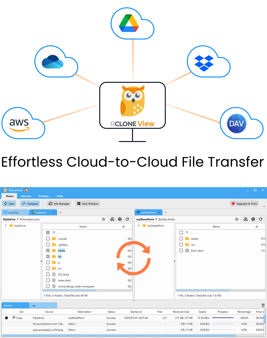
Manage & Sync All Clouds in One Place
RcloneView is a cross-platform GUI for rclone. Compare folders, transfer or sync files, and automate multi-cloud workflows with a clean, visual interface.
- One-click jobs: Copy · Sync · Compare
- Schedulers & history for reliable automation
- Works with Google Drive, OneDrive, Dropbox, S3, WebDAV, SFTP and more
Free core features. Plus automations available.
Centralize Data from Multiple Job Sites
Survey crews often return from the field with data on local drives, NAS units, or FTP/SFTP servers set up at the site trailer. RcloneView connects to all of these alongside 90+ cloud providers — including S3-compatible object storage that many firms use for long-term archival of raw scan data. With two or more Explorer panels open side by side, a project manager can browse a field laptop's raw folder next to the firm's cloud archive and confirm exactly what's landed before clearing local storage.
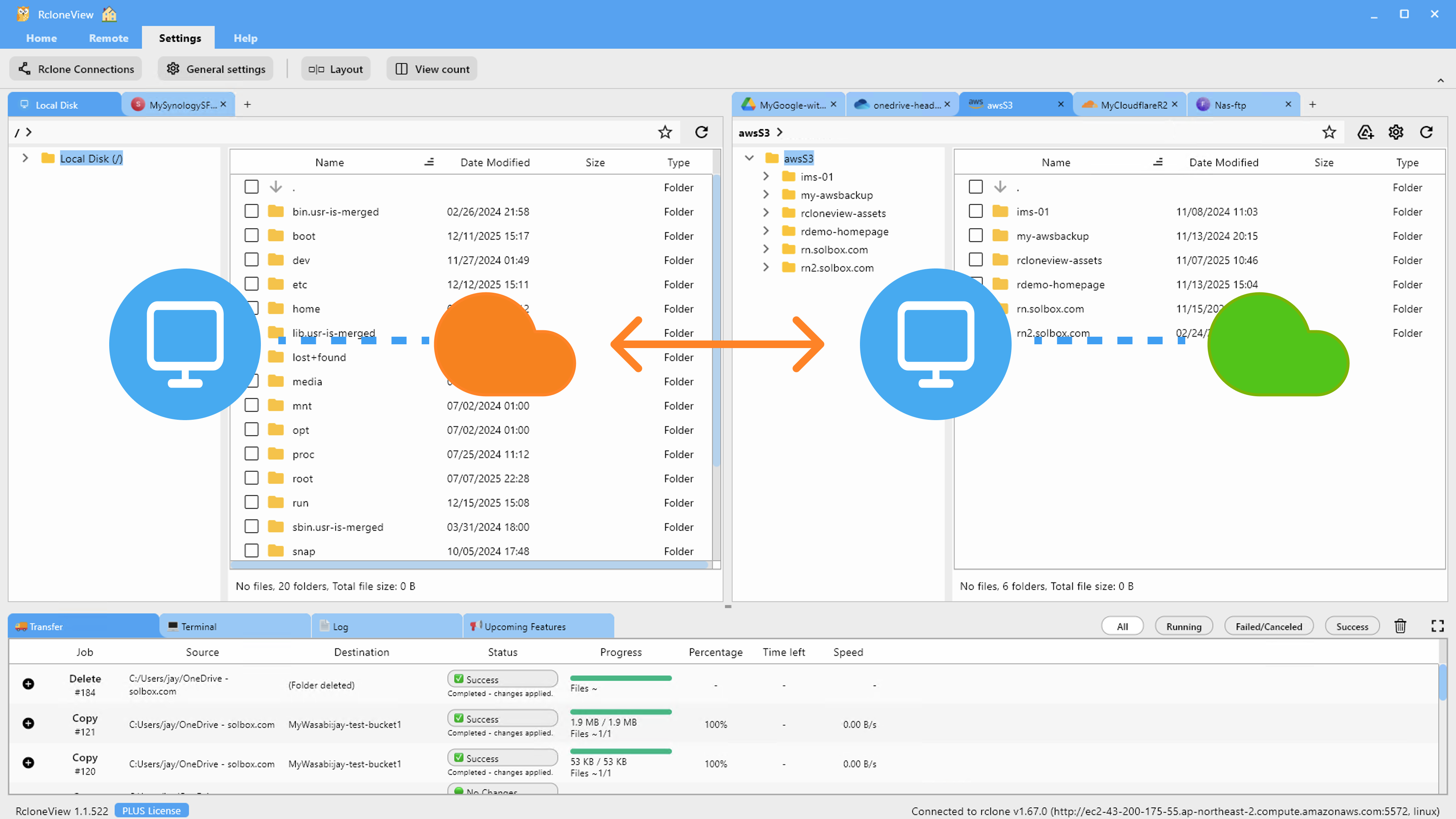
The Get Size action is particularly useful here — right-click a project folder to calculate its total size before starting a transfer, so crews can plan around bandwidth limits at remote sites rather than starting an upload that stalls halfway through.
Automate Nightly Uploads from Field Storage
Instead of relying on someone remembering to copy files at the end of each day, set up a Sync job from the field workstation's project folder to a cloud archive remote. Filtering rules can exclude temporary scanner cache files or thumbnail previews so only the finished dataset gets uploaded. RcloneView mounts AND syncs 90+ providers from one window, on Windows, macOS, and Linux, so the same job configuration works whether the field machine is a Windows laptop or a Linux workstation running the scanning software.
Verify Uploads Before Clearing Local Storage
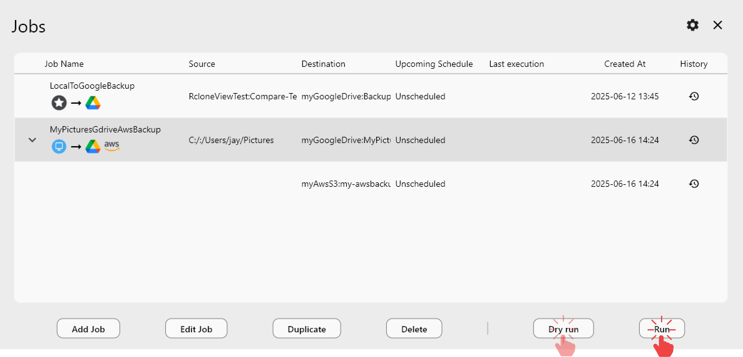
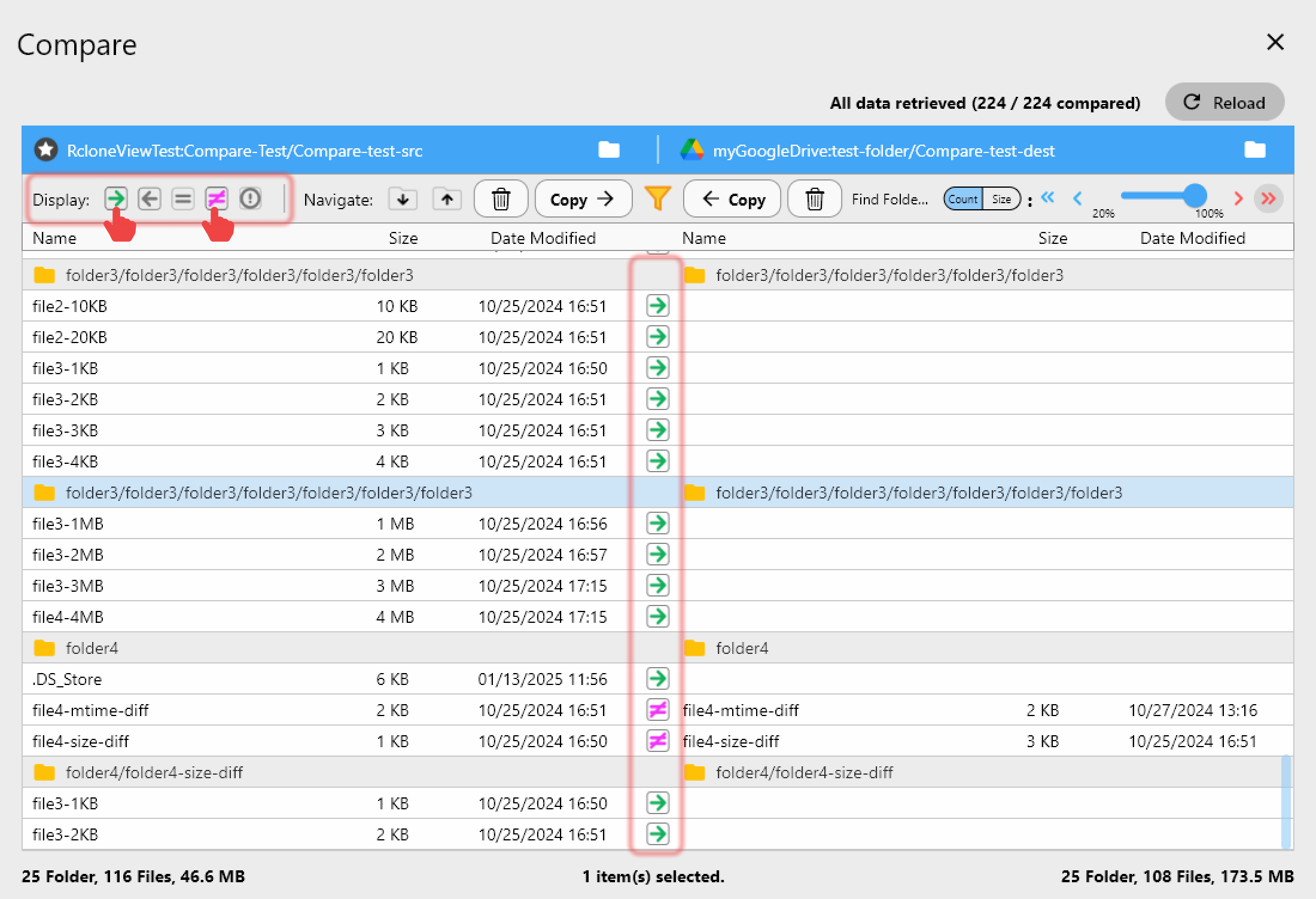
Losing a day's LiDAR scan to a bad upload is expensive to redo. Run a Dry Run before any sync to preview exactly what will transfer, then use Folder Compare afterward to confirm the cloud copy matches the field data file-for-file — including size checks — before anyone deletes local originals to free up drive space for the next site.
Keep the Office Archive Organized
Once data reaches the cloud, scheduled sync jobs can mirror finished projects into a secondary archive remote for redundancy, with Job History providing a timestamped record of what was transferred and when — useful for client deliverable tracking and internal QA.
Getting Started
- Download RcloneView from rcloneview.com.
- Connect your field storage (SFTP, local drive, or NAS) and your cloud archive remote.
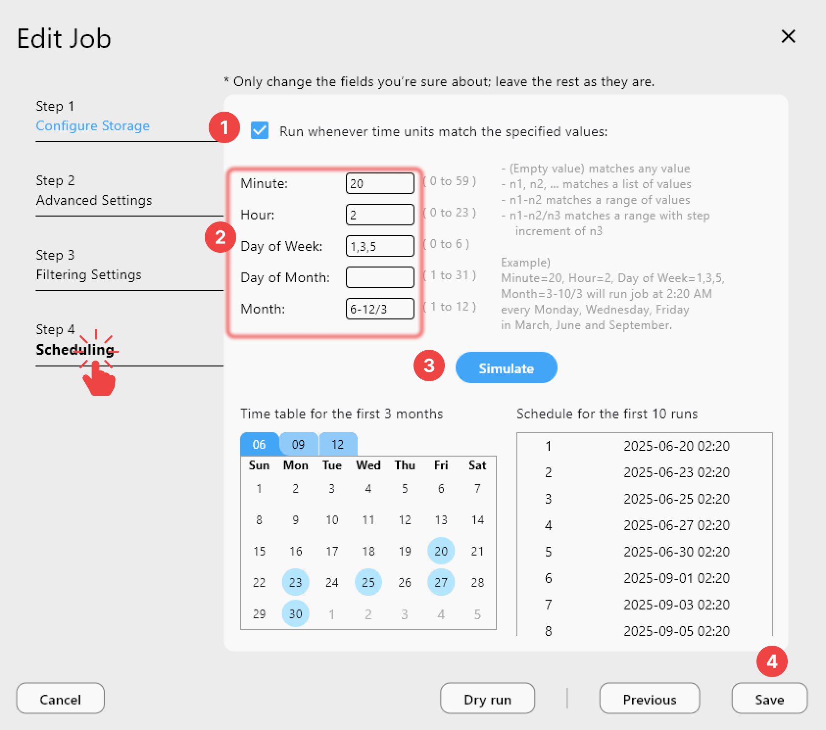
- Create a Sync job with filters to exclude temporary scanner files, then run a Dry Run.
- Schedule the job to run after each field day and check Job History to confirm completion.
With field data moving reliably to the cloud every night, survey teams spend less time babysitting uploads and more time on the next site.
Related Guides:
- Cloud Storage for Construction Project Management
- Cloud Storage for Architecture, Engineering & CAD
- Multi-Cloud Backup Strategy with RcloneView
Supported Cloud Providers